Sunday, December 14, 2008

Day 133 to Day 137

Day 133 December 10 Wednesday
Went to the internet place here in town and updated my blog and sent a few emails and did a little financial stull. Decided to go north on the Great Alpine Highway to Mt. Hotham where there is a big ski resort. When I got there I did not think it was as nice a place as Mt. Buller. The base area did not have much room and the roads were very steep. I went for about a 3km return hike along a ridge and back along the side. Very nice views. On the way back down stopped at Victoria falls which is the site of an old dam for making electricity for a mine. Dam is mostly gone and you need a 4x4 to get to the falls. Drove back to Swift Creek and spent the night at the city run caravan park. The English couple that were there last night were still there.
Day 134 December 11 Thursday
Left Swift Creek and headed south to Bairnsdale, When I was a long way away remembered that I forget to give back the ammenities block key so I am out the ten buck deposit. Not about to go back. Got oil and filter for the van in Bairnsdale. Took C 601 north to Mitchell R. National Park. Went to the Den of Nargun. It is a cave with a waterfall. Nargun was an aboriginal monster half man and half rock. When you threw a spear at it the spear came back and if little kids came to the pool it would catch them and drag thm into the pool. Further on was a woman’s cave called Deadcock Cave. (Translation from aboribinal words?) Hike to the Mitchell river. Left there and drove further up C601 to a road that went to Angusvale. It was a good unsealed road that went 16 km to a very pretty campground. Even though it was early I decided to spend the night there. As I was reading a book just before dark, a cute little wombat came walking towards the van from across the field. It got to within 50 yards and then turned and walked away up the hill. Great although the picture was not good because of poor light.
Day 135 December 12 Friday
When I awoke, there was fog almost down to the van. A bunch of kangaroos were in the field. It cleared up after a few hours and I drove back out of the park and down C601 to A1. Headed west to Sale when I took A440. After a few km, I stopped at the Sale Wildlife Refuge and too a km walk through the small lakes. Saw some pelicans and other birds. I continued on and then too C485 all the way to Loch Sport where I had lunch by Lake Victoria. Drove back a ways and took the road south to Golden Beach. There were campsites all along the ocean so I stopped at C7 sites. Late in the afternoon a ranger came and she told me that a big wind and rain storm was coming overnight. It started raining shortly after she left.
Day 136 December 13 Saturday
No wind overnight as far as I know but some rain. Drove down the road to Seaspray. Then took C496 to A440. Heard on the news that Melbourne had the highest 24 hour rainfall in a year at 42 mm. I saw lots of water along the road. At Yarran took the road to Tarra-Bulga State Park which is a temperate rainforest. Stopped at Tarra waterfall and it was flowing well. When I got to the park hiked a 1.5 km loop trail to Cythea waterfall. The ferns and big trees are fun to walk through. Headed further into the park and walked the loop to the swinging bridge back to the car park. Saw two lyre birds which did not stick around long. Drove a dirt logging road back to town, the Bulga Park Road. At Welshpool, drove up into the hills to see Agnes waterfall. It was a dam across the top of a chasm and the water. At Foster headed south on the road to Wilson Promontory. Decided to spend the night at Panakie Caravan Park on the east side of the peninsula. It had started to rain and by evening it was raining and blowing.
Day 137 December 14 Sunday
Since it is suppose to be windy and rainy today decided no to go to Wilson Promontory until after I get back from Tassie. Drove into Yanakie and called Spirit of Tasmania about my email tickets. They said they would send them again. Really not needed since I have confirmation number and photo ID. Drove to Fish Creek and then south on C445. Took a side to Waratah Bay a cute community on the water. Then drove to Walkerville North and then South where there were some old lime kilns that provided lime to Melbourne in the early days. Then to Cape Liptrap lighthouse and the Cape Liptrap NP. Continued on to Venus Bay a real tourist trap type of place. Drove then C442 to Iverloch and followed the coast line to Cape Paterson. Very pretty coast line. Managed to get a pic of an echidna before it scampered off into the bush. Headed through Wonthaggi and went to Phillip Island. Spent the night at Amaz’n Things Holiday Park space 8.

Tuesday, December 9, 2008

Day 124 to Day 132

Day 124 November 30 Sunday
Continued south on B140 to Warrnamboll then took Princess Highway east to B100, The Great Ocean Highway. Stopped at the following places: Bay of Isles, Bay of Martyrs, The Grotto, London Bridge, the Arch. Spent the night at Port Campbell in the caravan park, space 8. Very pretty coast. I can see why it is so popular.
Day 125 December 1 Monday
Left Port Campbell and stopped at Loch Ard George, and the Apostles which was spectacular as promised. Except today was very windy all day with rain squalls. Had to wait so get some pictures in at least partial sun. Went for a walk in the temperate rain forest at

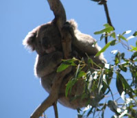
Melba Gully State Park. Just like Jurassic Park with huge ferns and jungle. Stopped at Joanna beach named after a ship wreck. On the way to Cape Otway light house, there were lots of red gums there and saw six kolas there, one with a baby. Spent the night at Apollo Bay.

Day 126 December 2 Tuesday
Continued on B100. Just before Lorne, I hiked the short distance to Seaoak Falls. Since the area is in a draught, very little water was coming over. At Lorne, drove the 16 km to Erskine Falls, also not a lot of water but still pretty. Went to the Information Center and went on-line for ferry tickets to Tasmania. Leaving Dec. 16 and returning Jan 5 at a cost of $360. The trip over for the driver was half off at $50. The vehicle is $65each way. It will be during the height of the holiday travel season. Christmas and New Years in Tas. Hope I can find places to stay. Continued to Split Point Lighthouse and walked around. All the little towns along the way had very nice beaches. Most were filled with kids surfing since it is only a few hours at most drive from Melbourne. Went through Geelong, a major city, using hwy A1 again. Just out of town took C704 to Bacchus Marsh (yes two c’s). Spent the night at the caravan park.

Day 127 December 3 Wednesday
Left Bacchus Marsh and headed to Ballarat on M8. Then took A300 north following the Goldfields Tourist route. At Daylesford headed north a short distance to Hepburn Springs. There is an old spa there and a nice brand new one. The springs are soda water with a sulfur smell and tasted awful. Besides baths there were all kinds of spa treatments. Ate lunch at Mt. Franklin and drove to the top. No view. Drove all the way to Echuca on the Murray River. The river is pretty much the border with New South Wales. Spent the night at a park along the river. Did not appear to be flowing and looked stagnant.

Day 128 December 4 Thursday
Drove into Echuca and took A300 to C355 to Shepparton. Just east of town took C366 south to Merton where I headed West on B300 then C516, then B340 to Alexandra. Just outside town took to road to Eildon National Park. It is big reservoir with mountains all around. Spent the night at Lakeside campground space 44. A few spaces away was a group of about 30 salespeople spending the night having a party. Went for a walk a short distance around the lake.

Day 128 December 5 Friday Lake Eildon

Left the campground and drove the Skyline Rd to Eildon, a small resort town on the lake. Went up to and drove across the hydroelectric dam to Pinninger Lookout with nice views of the reservoir. Went to the Cathedral Mountains State Park. Went to Neds Campground and hiked the one hour to Neds saddle and then the 15 minutes to Neds Peak. View not good because of the trees. Drove to the end of the road, rough and steep to Sugarloaf Saddle. I hiked (climbed )
to the top of the peak which was about a half hour trip. The last half was a definite class three climb and I took the easier of the two routes. Very nice views. Decided to spend the night in the park at Cooks Mill campground. Flies were not bad at all. Tired today after all the hiking in the warm weather.
Day 129 December 6 Saturday
Left Cooks Mill camp and drove B360 to B 300 to Mansfield. Along the way saw for sure my first wild echidna so I could not stop because there was no shoulder on the road and someone was tailgating me. Took the road to Mt. Buller which is a big ski resort. Long steep twisting road
again to the resort. Mountain is 1800 meters high (about 5400 ft). Hiked about 1.5 km to the very top. Nice and not too much wind but cool. Ate lunch there. Drove back to Mansfield. The road from Mansfield to Whittfield on C321 was through the mountains and the road was curvy and steep in places. Very pretty. Continued on to Moyhu where I spent the night at a cute little caravan park space 12.
Day 130 December 7 Sunday
Left Moyhu and continued north on C 321 to C521 which intersected the Great Alpine Road near Myrtleford. At Myrtleford took the road to Mt. Buffalo lake which is a man made reservoir, which was full. Walked around there a little and had a snack. Went back to Myrtleford and took the Great Alpine Road to Buffalo NP. Named so since an early explorer thought it looked like a sleeping buffalo. The mountain is granite and has a plateau at the top. Drove up another steep and windy road to the plateau and had lunch at Lakeside Park and campground at Lake Cataril. Drove to the end of the road and hiked up the 1.5 km trail to the summit of The Horn at 1732 meters, the highest point in the park. It is amazing on the trail they jack hammered steps in the granite. Very good 360 deg. views and very little wind for a change. It was cool, in the 50’s. Drove back down and decided to climb the Hump which is1695 meters. The trail goes past the Cathedral which is a rock climb. Nice views from there too. Drove down to the entrance and had my entry changed to two days as this is a very nice park. Went past the town of Bright a short distance and spent the night at Freeburgh Caravan Park space 25.

Day 131 December 8 Monday
Drove back to Mt. Buffalo NP. Hiked to Eurobin Falls about 1.5 km return. Actually Ladies Bath falls and upper and lower Eurobin falls which were good. Drove further up the road and hiked the 4 km return trip to Rollasons Falls which has upper and lower falls. Lower falls were pretty but the upper falls did not have a very good view. Then drove to the reservoir picnic area which was down about a 6 km single lane dirt road. From there hiked to Og, Gog and Magog rock formations on almost a way trail for a 4.5km return trip. Decided then to hike up to the Monolith which was close by. Hiked the 1.5 km to the rock outcrop and found that they had closed the final stepped for safety reasons. Nice views from there. Getting late so headed back to Bright and got a few groceries. Could not find internet café with wireless or ethernet for my laptop. Stayed at Freeburgh Carvan park again. The owners are from Sao Paulo, Brazil.
Day 132 December 9 Tuesday
Left the nice campground and went back to Bright to mail some things and get some petrol. Drove to the town of Mt. Beauty via C536 and C531 and continued to Falls Creek Alpine Village, a ski resort. Not as nice as Mt. Buller in my view. Checked on the dirt road to Omeo and was told it was ok. All alpine country most of the way. Hiked up the one km trail to Mt. Cope for some nice views. Saw two young researchers for Melbourne doing plant studies. Continued driving through the Alpine NP to Omeo, Dirt road was ok but steep and twisty and narrow but pretty and fun. Drove past Omeo to the town of Swift Creek and spent the night at the city owned campground.

Saturday, November 29, 2008

Day 116 to Day 123

Day 116 November 23 Sunday
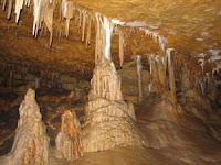
Yesterday when the wind was blowing so hard it lifted the roof of the van and broke one of the fasteners holding it down. Had to use a piece of rope to tie it in place. Will look for something to fix it when I get to a bigger city. Left Kingston SE and headed south on B1 to the road to Naracoorte. I then took A66 south to Naracoorte Cave NP. It is limestone cave system with bones of animals from animals from 350,000 years ago to the present. The scientists figure they fell down holes into the cave and could not get out. The museum there had life size critters that moved. Very well done. Took the Victoria Fossil cave tour to see where the fossils were found. Spent the night in the park campground. At dinner time, a male and female fairy wren hopped into the van for a look around. They are so cute.

Day 117 November 24 Monday
Left the caves campground and headed to Mt. Gambier. Found a caravan repair place and went to see if they could fix my roof. No but told me to look into the rubber things truckers use to hold their hoods down. Auto parts store did not have anything. Went to Bunnings, which is the equivalent of USA’s Home Depot. Found some brackets that I could put bungee cords over. I put two of the four in at Bunnings parking lot. Bought enough to do the other two. Seems to work ok. Went to Blue lake which is a lake in a crater made by a volcanic eruption 4500 years ago. Mt Gambier is built on the side of the crater. Very pretty, with walk ways all around. It is the cities water supply. Headed further south to Port MacDonell. There was suppose to be a pigmy penguin colony there but could not see any. This is the furthers point south in South Australia. The South Pole is suppose to be only 5700 km away. On the way back to Mt, Gambier stopped at Mt. Schank volcano and spent the night. Put in the other two brackets and bungees.Day 118 November 25 Tuesday
After breakfast hiked up to the top of the Schank crater and walked around the 1.5 km trail. Good views inside and outside the crater. Drove back to Mt. Gambier and took A1 out of town and just before crossing into Victoria took B160 to Hamilton then A200 north. Good news that petrol was only A$1.16 a liter. Whee. Spent the night at Gambier NP Buandik campground where some aboriginal rock art, Billimina shelter, is found. Think I am coming down with a cold.
Day 119 November 26 Wednesday
I did catch a cold. Rats. Left the campground and headed to the other nearby aboriginal site, Manja shelter, a 2.6 km round trip hike. On the way a huge emu jumped out in front of me and ran up the trail. It looked as tall as me. Ants on the trail about an inch long. Big suckers. Took some pics of the artwork. Headed back to A200 north towards Horsham. Turned right at Brimpean and then right on C222. Went down Roses Gap road a little further on to see Beehive falls. As I started up the trail, no water was coming down the creek so I quit. Had lunch a Zumstein picnic grounds. Went to Reed lookout and then hiked to the Balconies (looks like a dragon head). Fantastic views. Drove next to Boroka lookout for view to the East and South. I went to the park headquarters to get a camping permit and spent the night at Borough Huts campground. Opened up the back of the van and four crimson rosellas were there to see what they could get. Got rid of them but they kept coming back to make sure. Landed on my van, chair, and shoulder. Went to bed early.

Day 120 November 27 Thursday Happy Thanksgiving!
After breakfast drove up Mt. Williams road to the carpark. Hiked the 2.2 km of paved road to the top which is the highest peak in the Grampians at about 1180 meters. Nice views and the weather was good. Drove back towards Halls Gap and turned off at C218. Hiked the short distance to the Silverband waterfall. Very pretty. Then went to Mackinzie Falls. It was a long way down to see the falls which were very nice. Then drove to Lake Wartook which is a reservoir built in 1890. On the way back to Halls Gap took C122 to the Sundial picnic area. At Halls Gap spent the night at Takaru Caravan Park space 113. After dinner, a neighbor played the uke and sang US and Auzzie country western songs. Cold seems better but will get another good nights sleep.


Day 121 November 28 Friday
Had a hard time getting to sleep. Strange for me. Decided not to go to lookouts today because of low clouds and some rain forcast. Drove out of Halls gap to Mt/ Zero road but it was too washboardy. Went to Stawell and headed north to the Roses Gap road. Hiked up to Beehive falls but very little water was present. Went over the gap to hwy C222 and went to Stapylton campground. Took the short hike to Ngamadjdj art site. Only a few pics there. Spent the afternoon reading and relaxing.


Day 123 November 29 Saturday
In the evening a whole bunch of kids arrived at the park. It turned out they were going climbing at Hollow Mountain. I left the camp and drive to Hollow Mountain where there was another aboriginal art site. Then decided to hike up Hollow Mt. but near the top the trail was along steep edges so I decided to go no further. The young kids were getting ready to climb in the area. I drove back to hwy A8 and headed south. Then took A180 and C148 to Mortlake where I spent the night at the city camp ground. Thought of staying at Lake Bolac but this huge lake was completely dry. There is a serious water shortage in this part of the state of Victoria. I have to be out of the camp early tomorrow as 3200 bike riders and 1900 support staff will be staying at the camp ground and will be heading to the Grampians. Glad to be out of there.


Saturday bowling